Launching a new satellite constellation requires a huge amount of effort to ensure that the ground segment is installed correctly and calibrated prior to launch. With large constellations launching in LEO, this can be a complex and challenging task yet at the same time vital to ensuring smooth operation. How can operators prepare the ground segment accurately without causing significant delays to launches?
LEO: A Unique Ground Segment
As more and more LEO satellites continue to launch, this can only be good for breathing fresh air into the satellite industry. While there will likely always be a place for GEO, LEO will be essential for delivering universal telecommunications services on the move, whether in the air, at sea, or in rural locations. This will of course be vital not only for keeping people connected but also for emergency response. At the same time, it is likely that we will see LEO satellites paving the way for next generation services, from smart cities and driverless cars to delivery drones.
While the value proposition of LEO is well understood, LEO satellites have very unique requirements for ground segment infrastructure that cause a certain amount of complexity. We know, for example, that comms on the move terminals are a large cause of satellite interference, because of the dynamic nature of these systems. Now we are looking at satellites that are themselves dynamic and that could make them more prone to errors and a potential cause of interference.
Operators need to be mitigating this even before launch, which means that ground terminals need to be able to easily make before breaking the connection, or otherwise seamlessly connect and re-connect to these satellites. It also means operators need to know, prior to launch, that these terminals are working as they should be.
Testing Limitations
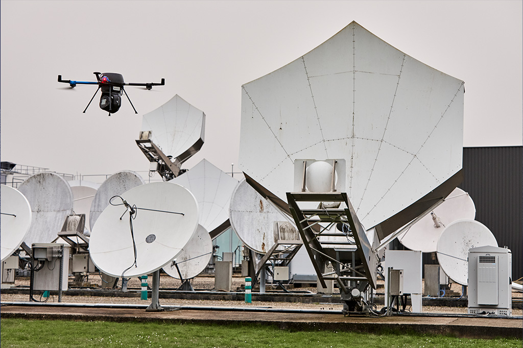
Testing prior to launching a constellation comes with a number of limitations and challenges. Most accurate testing requires ground antennas to be transported to a test site. While this is highly accurate, it is expensive and time-consuming, and certainly not feasible for the amount of terminals required for large LEO constellations. It also means that you cannot take into account environmental conditions at the ground station itself, which can often impact operation. It is not surprising therefore that most LEO operators are looking for ways to test the equipment in-situ.
The unique nature of LEO means that one of the most important elements to test is how the antennas are able to handle passes to switch between satellites as they orbit the earth. Generally, this is done using existing LEO / MEO satellites. While this can work well, it has its limitations. Beam pointing is limited to only where that constellation has users or gateways. In the case of new constellations in particular, or new regions, this is often too limiting. This method also means having to wait for the satellite pass to happen to perform the test. This involves a great deal of planning and patience to get the timing right to do this effectively.
Simulating Orbital Passes
When we set out to develop drone-based antenna testing solutions, we knew it would be important to replicate the accuracy of testing facilities wherever the test takes place. We have done this to great effect and have already worked with a number of operators to perform highly accurate tests on site.
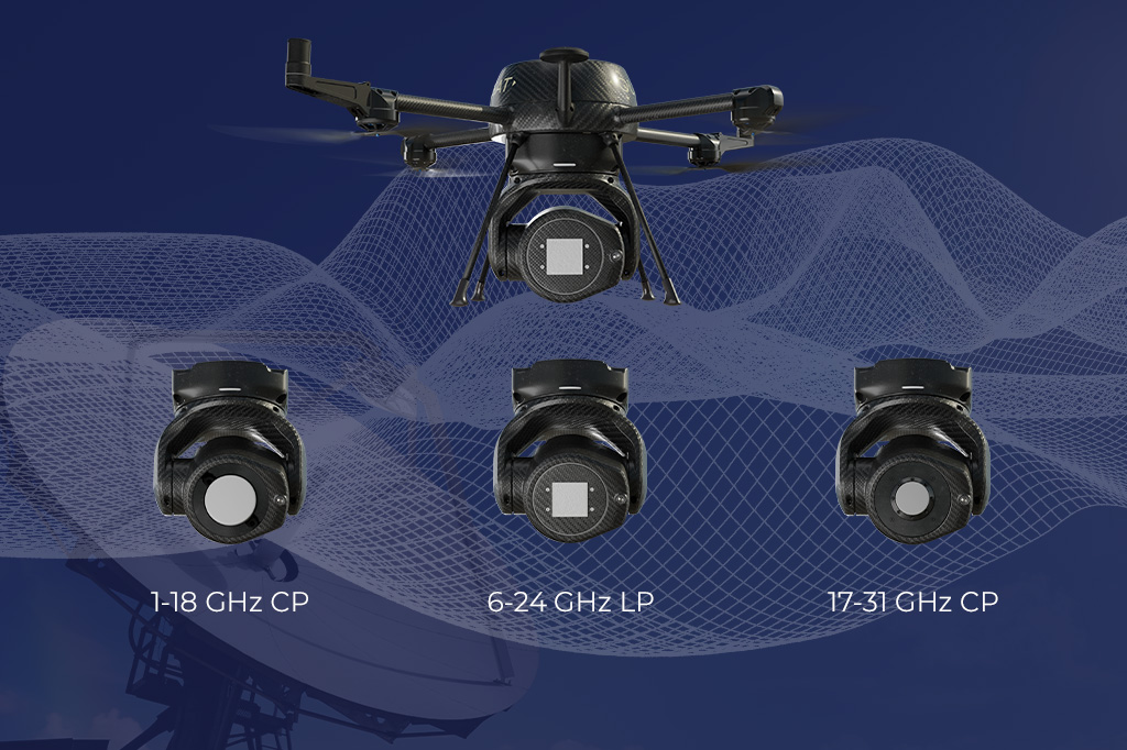
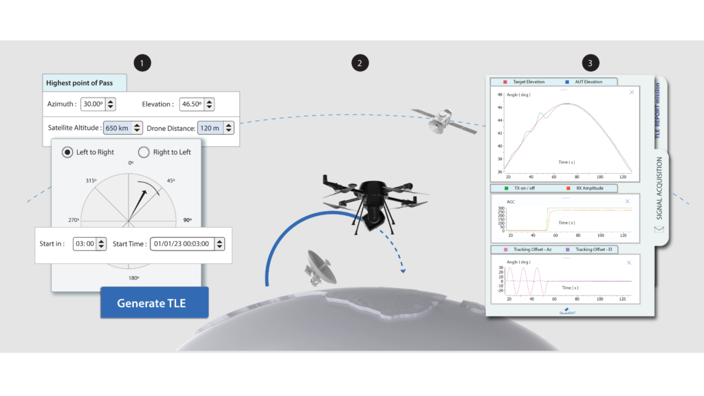
Our most recent challenge was to look at a way for our drone system to perform virtual orbital passes and accurately simulate a satellite as seen from the antenna on the ground. By equipping the on-board microcomputer with a way to decode Two-Line Element (TLE) sets, we are able to generate virtual passes from any direction and at any elevation angle. Essentially, the payload on the drone acts as the satellite transponder, transmitting a test signal which the antenna can lock itself onto.
As well as ensuring accurate testing of those passes, we can enable operators to avoid unforeseen delays that occur when the antenna is unable to acquire the live satellite.
Satellite operators can create an on-demand simulation environment to:
- test and verify the antenna pointing offset across its operational range
- verify the antenna tracking capability
- test real life operational scenarios
The payload is also able to simulate the Doppler shift, as well as the signal variations due to distance path loss or atmospheric attenuation. We also foresee the ability to programme various other test scenarios, such as simulation of rain fade or launch and acquisition of a new satellite.
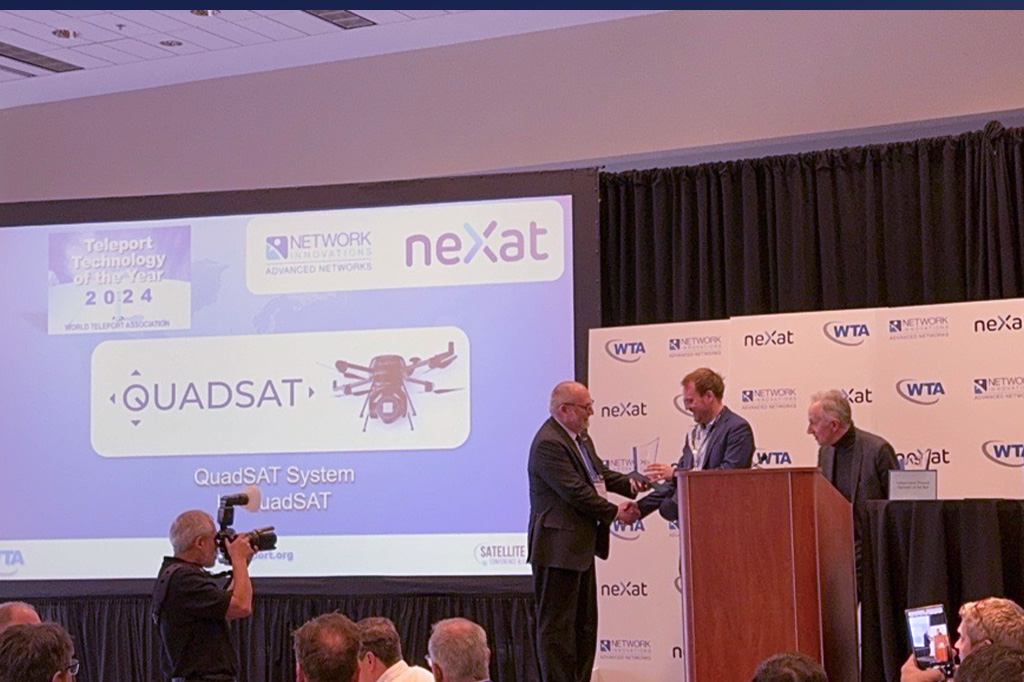
If you want to find out more, you can read the press release, download the technical specification, or get in touch to discuss your requirements.